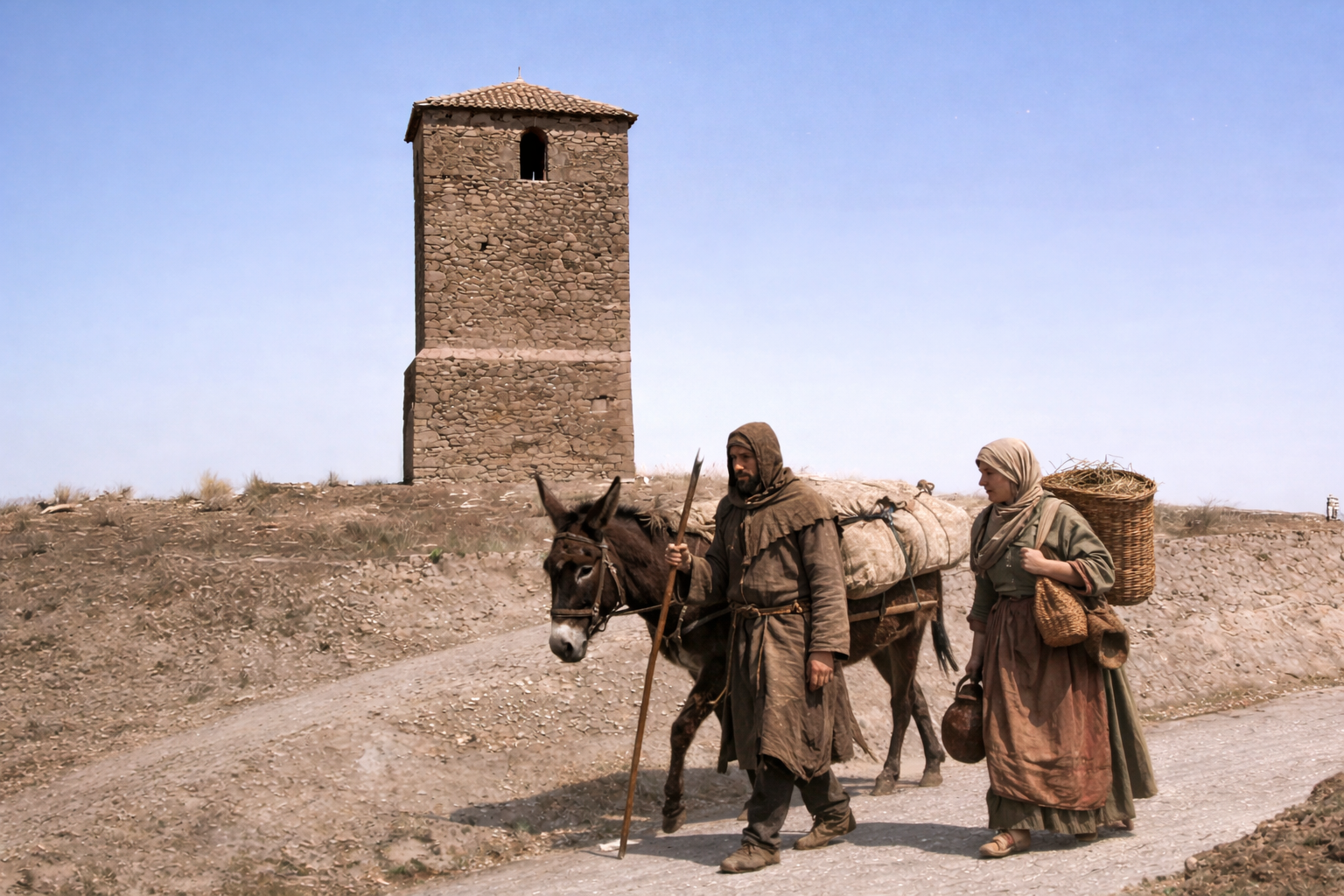
The Tower of Villalboñe has stood for so long that it is difficult to imagine a landscape without it. It does not stand out for its monumentality or heroic gesture: its square plan, its three tiers—two in stone and one in brick—and its modest scale allow it to blend naturally into its surroundings, much like ancient paths, gentle hills, or the edges of the valley. For centuries, it has been a constant presence.
The Tower of Villalboñe has stood for so long that it is difficult to imagine a landscape without it. It does not stand out for its monumentality or heroic gesture: its square plan, its three tiers—two in stone and one in brick—and its modest scale allow it to blend naturally into its surroundings, much like ancient paths, gentle hills, or the edges of the valley. For centuries, it has been a constant presence.
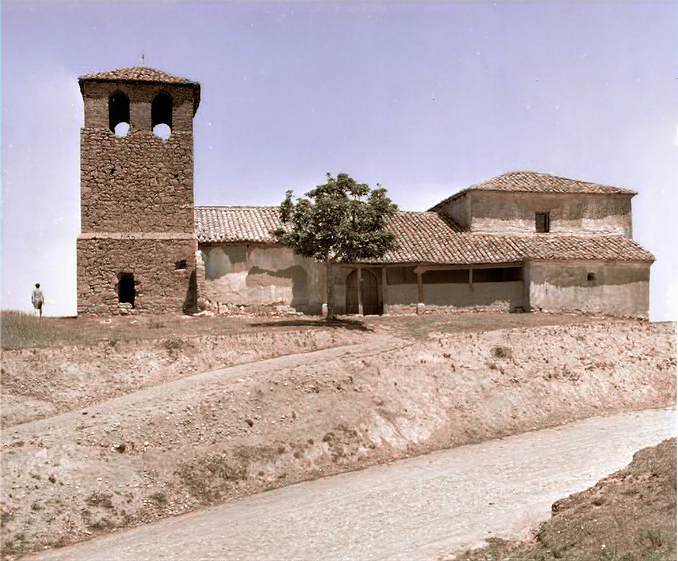
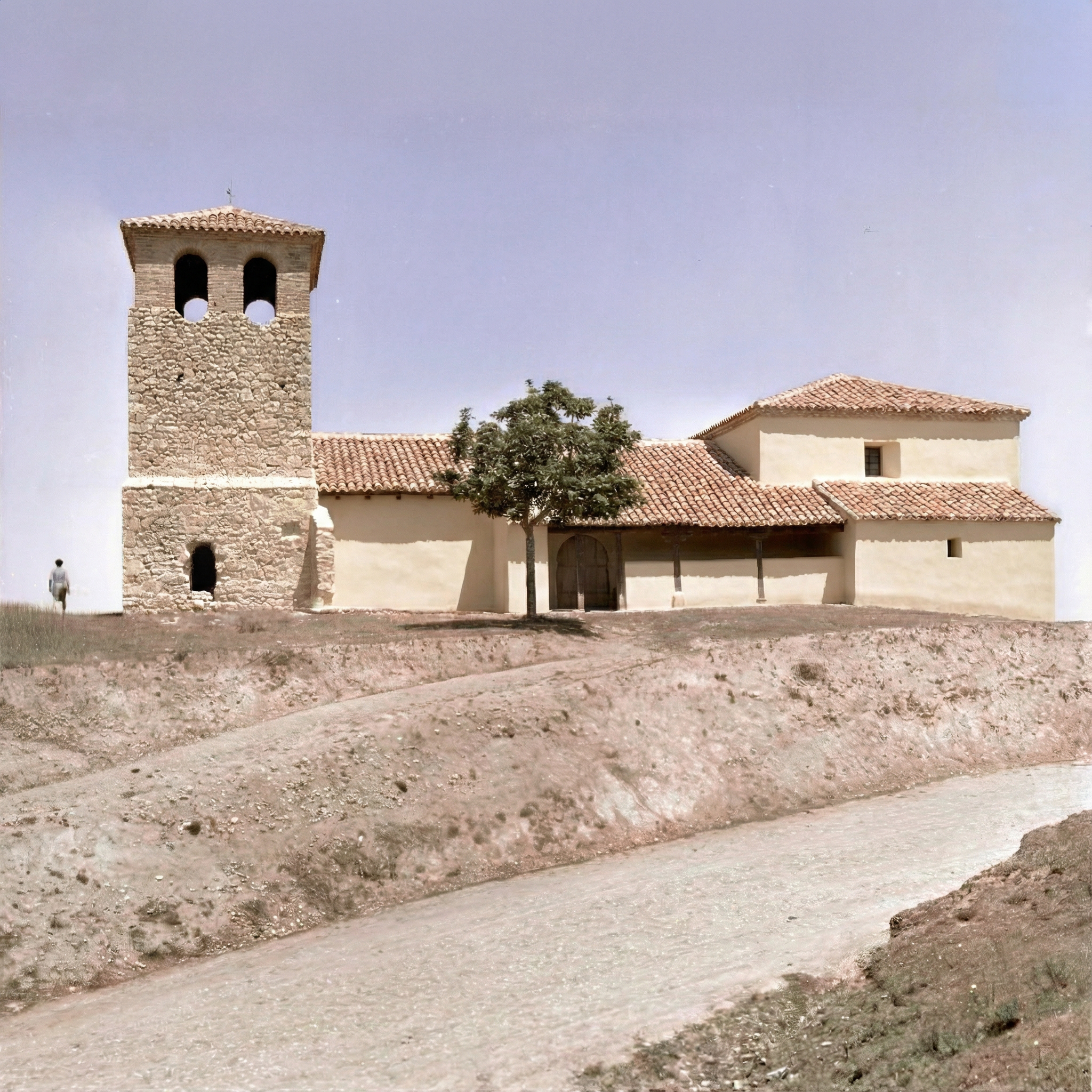
The structure as we see it today dates from the late 16th to the early 17th century, but it is very likely that the preserved tower corresponds to a building of medieval origin, since a primitive core of rammed earth and an old doorway—located in a position different from the present one—are preserved in the lower levels. This phenomenon of functional continuity without constructive continuity is well known in the northwestern Iberian Peninsula: the Middle Ages inherited and reused Roman territorial schemes, erecting new defensive, seigneurial, or symbolic structures on sites whose strategic importance had been established centuries earlier. The later transformation of the tower into the church bell tower, together with the persistence of the site as a sacred space and cemetery, reinforces the character of the enclave as a territorial and symbolic landmark, marked by prolonged occupation and successive re-significations over time.

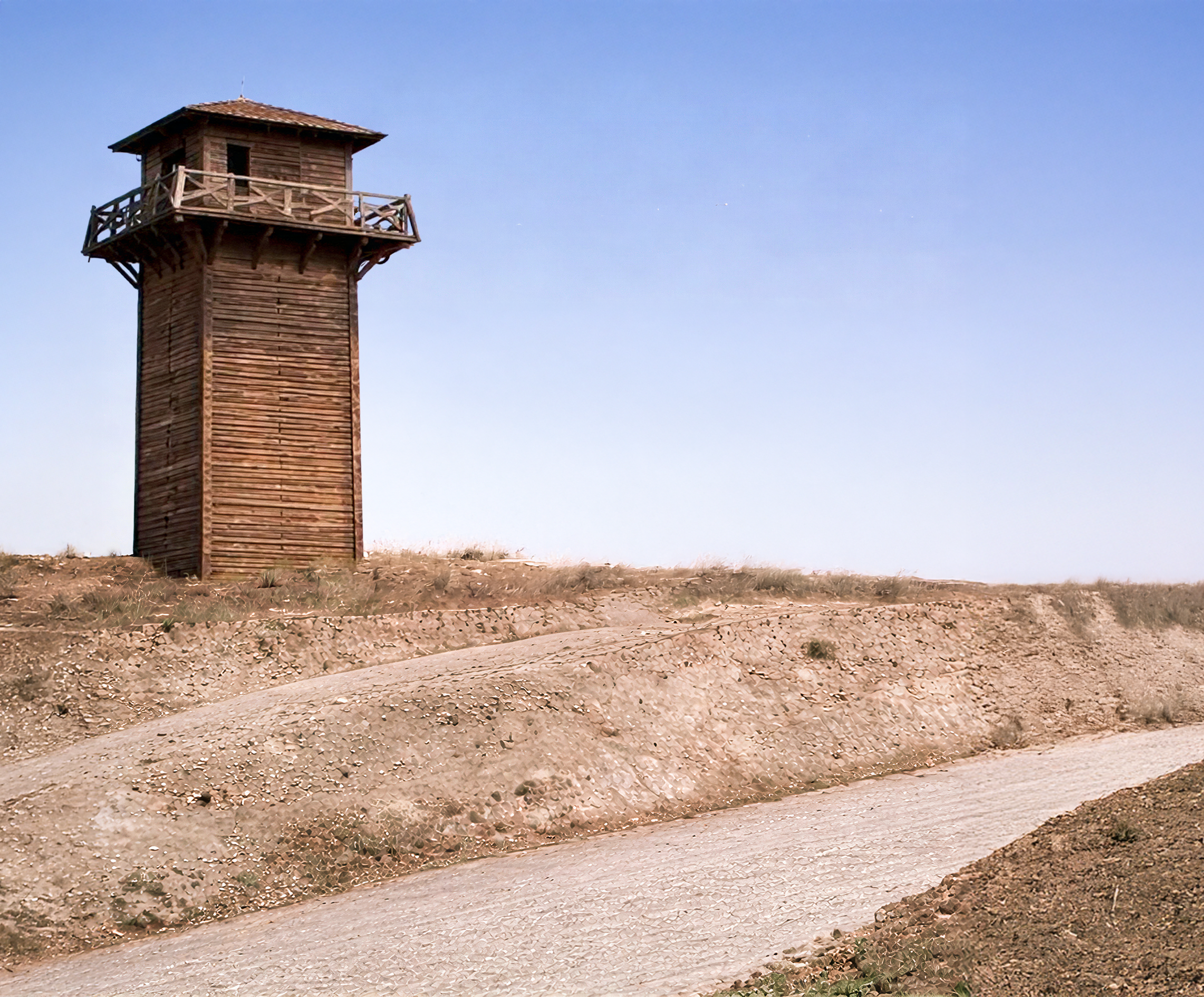
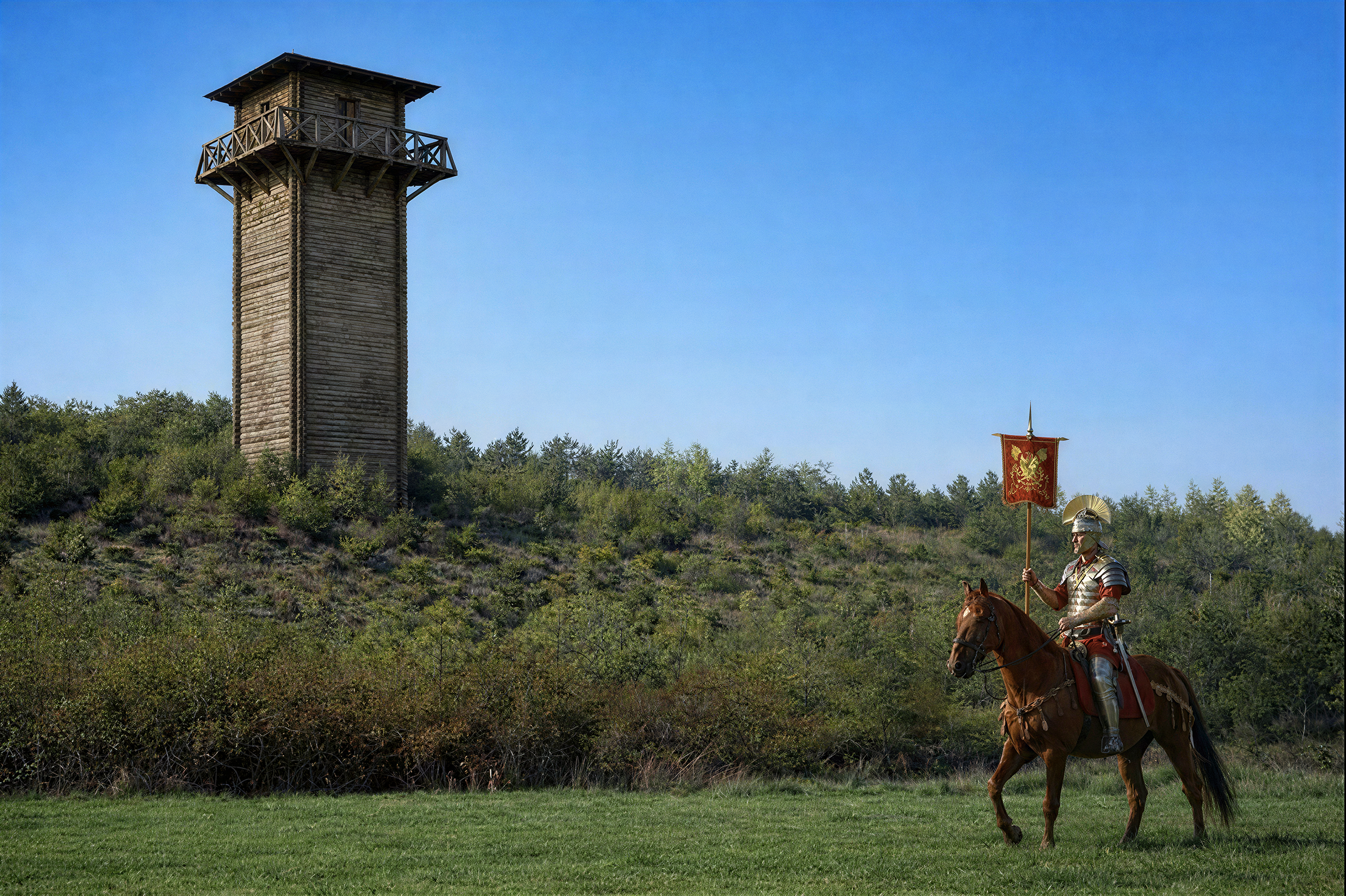
There is a tradition that attributes surveillance functions to the tower and maintains that from it one could see the ancient Roman city of Lancia. There is no archaeological evidence to confirm this, but neither is it a gratuitous hypothesis if the territory is carefully observed.
The tower stands on elevated ground that visually dominates the middle valley of the Porma River and the natural corridor that connects the Meseta with the eastern mountains of León. It is a landscape of gentle hills and fluvial terraces, long conducive both to movement and to continuous human settlement. Nothing about its location is accidental: it forms part of a broader territorial logic based on visual control, natural passages, and spatial organization.
The main historical reference in the surrounding area is Lancia, identified with the archaeological site of El Castro in Villasabariego, one of the most important urban centers in the northwestern Iberian Peninsula during pre-Roman and Roman times. Classical sources place here one of the decisive episodes of the Asturian-Cantabrian wars, with the capture of the city in 25 BC. Around it, archaeological research has documented a dense network of Roman military enclaves, among which the large camp of Villacete stands out, covering more than 28 hectares and discovered through remote sensing techniques, linked to large-scale military operations.
The proximity between Lancia and Villacete allows this sector of the Porma valley to be interpreted as a space that was intensely organized and monitored in Roman times. Roads, camps, river crossings, and elevated observation points formed part of a network designed to administer the territory, control resources, and secure movement. Rome did not operate through isolated points, but through hierarchical and interconnected systems.
In this context, it is not difficult to imagine that some form of elementary watchtower already existed in Villalboñe during Roman times—perhaps a light structure of wood or earth, now completely disappeared. Such installations—speculae or secondary observation posts—rarely leave visible archaeological traces, but they responded to a well-known strategic logic. In these cases, the landscape preserves memory better than documents.
Alongside military enclaves, river crossings played an essential role. The area of La Barca–Puente Villarente has historically been a key point for crossing the Porma, concentrating routes and infrastructure from Roman times to the present. The persistence of this crossing as a territorial node reinforces the idea of a spatial organization based on long continuities, beyond political or constructive changes.
The Tower of Villalboñe is located precisely in an intermediate position between Lancia, the camp of Villacete, and this river crossing. From its site, it is possible to exercise effective visual control over the natural corridor, the agricultural land, and the routes of transit. Although no direct Roman remains have been preserved on the spot, its location fully conforms to that ancient logic of visual dominance over the territory.
To this must be added the traditional presence of springs of possible Roman origin in the surrounding area, including one within Villalboñe itself, reinforcing the idea of a continuous occupation and exploitation of the space, with particular attention to water resources as structuring elements of settlement.
This phenomenon of functional continuity without constructive continuity is widely known in the northwestern Iberian Peninsula: the Middle Ages inherited and reused Roman territorial schemes, erecting new defensive, seigneurial, or symbolic structures on sites whose strategic importance had been established centuries earlier.
The later transformation of the tower into the church bell tower, together with the persistence of the site as a sacred space and cemetery, reinforces the character of the enclave as a territorial and symbolic landmark, marked by prolonged occupation and successive re-significations over time. It did not only watch: it also called, signaled, and gathered. Its function changed, but not its deeper meaning.
The place name “Los Quintos,” traditionally applied to the immediate surroundings of the tower, adds another layer to this reading of continuity. Common in the historical toponymy of Castile and León, it is usually associated with the division of communal lands or with medieval and early modern agrarian organization. Although it cannot be directly linked to Roman times, it is significant that it designates a topographically distinctive and strategically prominent space, reinforcing the idea of a persistent valuation of the site over time, beyond changes in name or use.
For centuries, the tower ceased to be actively observed and became part of the everyday background. It was neither destroyed nor aggressively transformed: it simply remained. Its oblivion was quiet. In 2022, the local council, with the support of the Valdefresno Town Hall and the Leonese Institute of Culture, promoted a respectful intervention that prevented its definitive deterioration and restored it to collective awareness.
That restoration did not merely consolidate a building; it also invited reflection on its past—not only the documented one, but also that other, more diffuse past that cannot be proven, yet cannot be dismissed either. The Roman past here is not an archaeological certainty, but an atmosphere made up of roads, names, nearby ruins, and dominant positions.
Today, those who pause before the tower may see it simply as a restored structure, or they may allow their thoughts to extend toward that broader horizon. Perhaps that is its true value: not what it asserts, but what it suggests.
The structure as we see it today dates from the late 16th to the early 17th century, but it is very likely that the preserved tower corresponds to a building of medieval origin, since a primitive core of rammed earth and an old doorway—located in a position different from the present one—are preserved in the lower levels. This phenomenon of functional continuity without constructive continuity is well known in the northwestern Iberian Peninsula: the Middle Ages inherited and reused Roman territorial schemes, erecting new defensive, seigneurial, or symbolic structures on sites whose strategic importance had been established centuries earlier. The later transformation of the tower into the church bell tower, together with the persistence of the site as a sacred space and cemetery, reinforces the character of the enclave as a territorial and symbolic landmark, marked by prolonged occupation and successive re-significations over time.
There is a tradition that attributes surveillance functions to the tower and maintains that from it one could see the ancient Roman city of Lancia. There is no archaeological evidence to confirm this, but neither is it a gratuitous hypothesis if the territory is carefully observed.
The tower stands on elevated ground that visually dominates the middle valley of the Porma River and the natural corridor that connects the Meseta with the eastern mountains of León. It is a landscape of gentle hills and fluvial terraces, long conducive both to movement and to continuous human settlement. Nothing about its location is accidental: it forms part of a broader territorial logic based on visual control, natural passages, and spatial organization.
The main historical reference in the surrounding area is Lancia, identified with the archaeological site of El Castro in Villasabariego, one of the most important urban centers in the northwestern Iberian Peninsula during pre-Roman and Roman times. Classical sources place here one of the decisive episodes of the Asturian-Cantabrian wars, with the capture of the city in 25 BC. Around it, archaeological research has documented a dense network of Roman military enclaves, among which the large camp of Villacete stands out, covering more than 28 hectares and discovered through remote sensing techniques, linked to large-scale military operations.
The proximity between Lancia and Villacete allows this sector of the Porma valley to be interpreted as a space that was intensely organized and monitored in Roman times. Roads, camps, river crossings, and elevated observation points formed part of a network designed to administer the territory, control resources, and secure movement. Rome did not operate through isolated points, but through hierarchical and interconnected systems.
In this context, it is not difficult to imagine that some form of elementary watchtower already existed in Villalboñe during Roman times—perhaps a light structure of wood or earth, now completely disappeared. Such installations—speculae or secondary observation posts—rarely leave visible archaeological traces, but they responded to a well-known strategic logic. In these cases, the landscape preserves memory better than documents.
Alongside military enclaves, river crossings played an essential role. The area of La Barca–Puente Villarente has historically been a key point for crossing the Porma, concentrating routes and infrastructure from Roman times to the present. The persistence of this crossing as a territorial node reinforces the idea of a spatial organization based on long continuities, beyond political or constructive changes.
The Tower of Villalboñe is located precisely in an intermediate position between Lancia, the camp of Villacete, and this river crossing. From its site, it is possible to exercise effective visual control over the natural corridor, the agricultural land, and the routes of transit. Although no direct Roman remains have been preserved on the spot, its location fully conforms to that ancient logic of visual dominance over the territory.
To this must be added the traditional presence of springs of possible Roman origin in the surrounding area, including one within Villalboñe itself, reinforcing the idea of a continuous occupation and exploitation of the space, with particular attention to water resources as structuring elements of settlement.
This phenomenon of functional continuity without constructive continuity is widely known in the northwestern Iberian Peninsula: the Middle Ages inherited and reused Roman territorial schemes, erecting new defensive, seigneurial, or symbolic structures on sites whose strategic importance had been established centuries earlier.
The later transformation of the tower into the church bell tower, together with the persistence of the site as a sacred space and cemetery, reinforces the character of the enclave as a territorial and symbolic landmark, marked by prolonged occupation and successive re-significations over time. It did not only watch: it also called, signaled, and gathered. Its function changed, but not its deeper meaning.
The place name “Los Quintos,” traditionally applied to the immediate surroundings of the tower, adds another layer to this reading of continuity. Common in the historical toponymy of Castile and León, it is usually associated with the division of communal lands or with medieval and early modern agrarian organization. Although it cannot be directly linked to Roman times, it is significant that it designates a topographically distinctive and strategically prominent space, reinforcing the idea of a persistent valuation of the site over time, beyond changes in name or use.
For centuries, the tower ceased to be actively observed and became part of the everyday background. It was neither destroyed nor aggressively transformed: it simply remained. Its oblivion was quiet. In 2022, the local council, with the support of the Valdefresno Town Hall and the Leonese Institute of Culture, promoted a respectful intervention that prevented its definitive deterioration and restored it to collective awareness.
That restoration did not merely consolidate a building; it also invited reflection on its past—not only the documented one, but also that other, more diffuse past that cannot be proven, yet cannot be dismissed either. The Roman past here is not an archaeological certainty, but an atmosphere made up of roads, names, nearby ruins, and dominant positions.
Today, those who pause before the tower may see it simply as a restored structure, or they may allow their thoughts to extend toward that broader horizon. Perhaps that is its true value: not what it asserts, but what it suggests.

Descubre la Sobarriba a través de un recorrido inolvidable por su patrimonio, cultura y paisajes. La Ruta Cultural de la Sobrarriba ofrece visitas guiadas y explicaciones detalladas en varios puntos de interés, combinando historia, arquitectura, tradiciones y naturaleza en una experiencia única.
Cada ruta está diseñada para adaptarse a diferentes tipos de viajeros: desde caminantes y ciclistas hasta quienes prefieren rutas a caballo o incluso en globo aerostático. Acompáñanos en un viaje en el tiempo y adéntrate en los secretos de una tierra que ha sido testigo de siglos de historia.

Descubre la Sobarriba a través de un recorrido inolvidable por su patrimonio, cultura y paisajes. La Ruta Cultural de la Sobrarriba ofrece visitas guiadas y explicaciones detalladas en varios puntos de interés, combinando historia, arquitectura, tradiciones y naturaleza en una experiencia única.
Cada ruta está diseñada para adaptarse a diferentes tipos de viajeros: desde caminantes y ciclistas hasta quienes prefieren rutas a caballo o incluso en globo aerostático. Acompáñanos en un viaje en el tiempo y adéntrate en los secretos de una tierra que ha sido testigo de siglos de historia.